Features Waldfinder Vorarlberg
Forest Finder – The Vorarlberg Forest PlatformImportant!
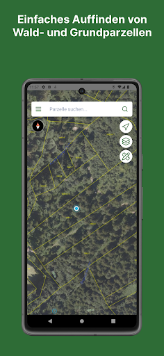
Data may be lost when updating from version 5 to version 6.In the forest finder app, existing geodata and aerial images are used together with the smartphones GPS positioning function to locate forest and land parcels.
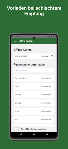
At the same time, some information on forest management and existing contacts are made available (on-site forest supervisors, timber marketing services, forest companies, funding, memberships, links, etc.).The latest update makes simple drawing and measuring functions possible, which can also be shared and sent (email and WhatsApp).
This means, for example, that information about a tree infested with bark beetles can be exchanged between the forest owner, forest supervisor and the appointed wood processor.
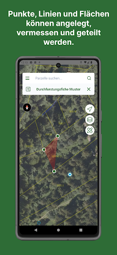
Afforestation or thinning areas can be specified.
Lines such as access routes or points such as border points, wood collection points or biotope trees can be shared for funding billing via email or WhatsApp.
Descriptions, notes and photos can be created for each “project”.- It becomes possible to easily find forest and land parcels.- Lots of explanations and information for forest owners and interested parties.- The existing forest community with some management tips can be accessed for your own forest plot.- Points, lines and areas can be created and measured.- A toolbox can be used to create useful queries and projects.- Descriptions including photos can be made and shared/sent.DI Thomas Ölz, forestry [email protected]+43(0)5574/400-460www.lk-vbg.at
Social Features
Connect and share with friends and the community.
Camera Features
Advanced camera features with editing capabilities.
Fitness Tracking
Track your workouts and monitor your health metrics.
See the Waldfinder Vorarlberg in Action
Get the App Today
Available for Android 8.0 and above